- Home
- San Francisco Attractions
- Twin Peaks San Francisco
Twin Peaks San Francisco
The Best San Francisco View!
I may earn a small commission if you make a purchase through some of the affiliate links on this page, at no extra cost to you. See disclosure policy. This helps me provide all the free information on the site. Thank you!
Want a spectacular 360 degree view of San Francisco? Head for the top of Twin Peaks, San Francisco.
San Francisco has lots of great viewpoints, but I think Twin Peaks has the best overall view of the city and its beautiful natural setting.
These two hills rise almost 1000 feet above the City and sit just about in its geographical center.
Twin Peaks is now accessible by car only via Portola Road. In 2020, the access from Clarendon Road on the other side was permanently closed to cars.
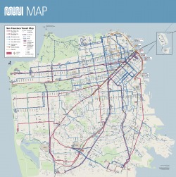
The 37-Corbett bus line goes up there, with good access from the Crestline Road stop.
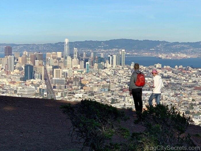 View of San Francisco from Twin Peaks
From the viewing area next to the parking lot at the top, you can see many of San Francisco's landmarks: the Golden Gate Bridge, Bay Bridge, Alcatraz, Transamerica Building, downtown skyscrapers and Market Street. Photographs just don't do it justice.
The San Francisco skyline has changed quite a bit since the Salesforce Tower was finished in 2018.
It's now San Francisco's tallest building (1,070 feet tall, about 100 feet taller than Twin Peaks' 922 feet), sticking up to the right of Market Street in the photo above.
At night, they do light shows on the tapered tip of the skyscraper. One Halloween, we had the Eye of Sauron glaring out from the tower!
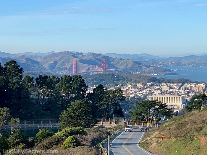 View towards the Golden Gate
Nice view of the Golden Gate Bridge and the Marin Headlands beyond.
Check my list of other great views of the Golden Gate and how to find them.
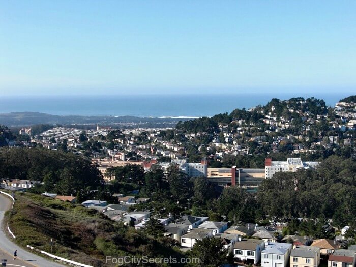 Looking towards the ocean
Look in the other direction and there's the Pacific Ocean and Golden Gate Park:
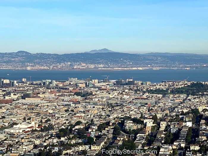 Looking towards Oakland
And looking east, a clear view of San Francisco Bay with the cities of Berkeley and Oakland across the water, and Mount Diablo in the distance.
Is Twin Peaks in San Francisco worth visiting?
Twin Peaks is definitely worth visiting! This is truly one of the most spectacular of all the San Francisco sights! Twin Peaks is where I like to bring my out-of-town visitors.
The view from Twin Peaks is one of the best views of the whole city of San Francisco (and the Bay Area) that you'll find.
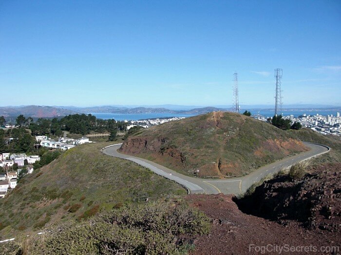 View from the southern peak,
looking north towards the other one.
View from the southern peak,
looking north towards the other one.Can you go to Twin Peaks at night?
Yes, you can come up here at night. Twin Peaks is open until midnight. every night. If you come up here on a clear night, the lights of San Francisco sparkle below you in every direction.
But I wouldn't advise coming up at night just now; there have been recent incidents of people being robbed up here after dark. Sorry!
Twin Peaks Odd and Ends
Twin Peaks wasn't called that by the Spanish settlers. They named it Los Pechos de la Chola, or The Breasts of the Indian Woman.
No one knows now what the Indians called it, but according to Ohlone legend, there was once only one mountain, consisting of a man and a woman. Because they wouldn't stop their constant arguing, the Great Spirit separated them, and they became two mountains.
What are those towers? The tall, red, three-pronged tower on a nearby hill (between Twin Peaks and Mount Sutro) is the Sutro Tower, a commercial radio and TV tower serving San Francisco and beyond.
The smaller steel towers near the Twin Peaks parking lot are city-owned, radio towers used for police and fire department transmissions.
Twin Peaks also hosts a large reservoir holding 300 million gallons, installed on the peaks after the 1906 quake as a water supply for fighting fires.
Twin Peaks Hours
Twin Peaks is open from 5 am to midnight daily.
It's one of San Francisco's best free attractions!

Insider Tips:
- Climb to the top. For an even better view, climb the rugged stairs to the top of one of the peaks. You really will feel you're floating above the whole Bay Area! I think the peak furthest from the parking lot (the southern one) has the best view, but they are both good.
- Try to go on a clear day. When it's foggy, Twin Peaks sits right in the middle of it and you won't see anything but swirling fog.
- Dress warmly. It can be very cold and windy up there, so bring a jacket, even if it's a warm day.
- Go early. Twin Peaks San Francisco is a popular place to come, for both locals and visitors. If you come before 10:30 a.m., there'll be fewer people. But even with more people up there, it's not that crowded; it just might mean waiting for a parking spot if you're driving. And most visitors don't climb the peaks. I rarely have to wait long for a space. Plus there are other places to park up there.
- Car break-ins have become a big problem in San Francisco, unfortunately. Don't leave anything valuable or visible in your car if you park here.
Are there bathrooms at Twin Peaks?
Yes, there are. Fancy ones! The restrooms are near the parking lot.
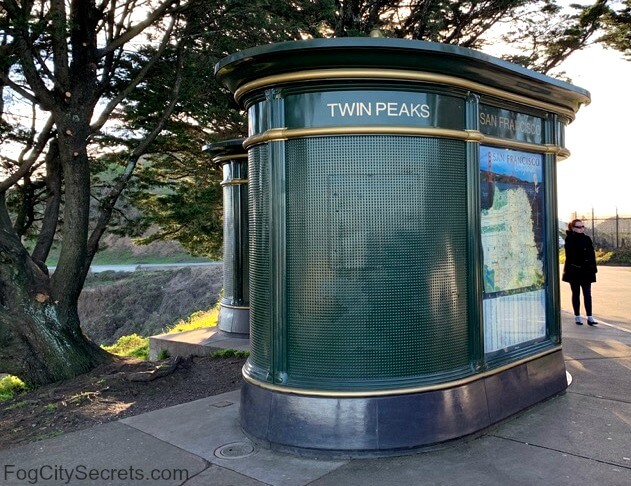 One of our faux-Parisian models.
Things to do at Twin Peaks
Climb one of the peaks
There are pathways up to the top of both peaks; really worth the climb.
They've recently been improved with rustic wooden stairs, so they're not as slippery as the dirt paths were after a rain. Not particularly strenuous, just watch your step.
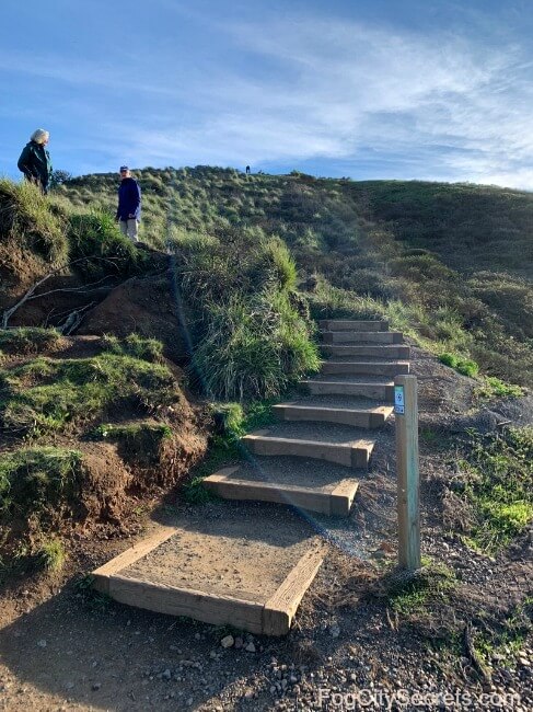 Stairs up to the top. Northern peak.
The Mission Blue Butterfly
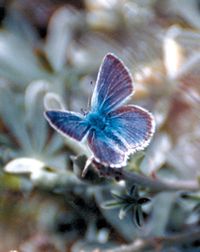 Mission Blue
In addition to having many native plants covering the slopes of Twin Peaks, these hills are the habitat for a pretty little butterfly that only exists two places on earth, Twin Peaks and San Bruno Mountain further down the peninsula.
The butterfly is endangered and lives on the Silver Lupine ground cover that does well on the peaks. The butterflies come out of their cocoons in April and May, and can be seen on the hills.
Getting to Twin Peaks San Francisco
Can you drive to Twin Peaks?
Yes, you can drive to Twin Peaks. Twin Peaks is very easy to get to if you have a car.
Just follow Market Street west (away from downtown) all the way to the top of the hill (where the name changes to Portola Drive), then turn right on Twin Peaks Boulevard. A short, winding road brings you to the free parking lot at the top.
The parking lot isn't large, and tends to fill up on clear days, but if you wait, a spot will usually open up before long. I drive up here; if you have a car, it's the easiest and most convenient way to get up here.
Road changes to Twin Peaks
The only access road up to Twin Peaks is now from Portola Road to Twin Peaks Blvd.
The road on the other side coming up from Clarendon Avenue is now closed permanently to cars. The parking lot that used to be there is now unavailable.
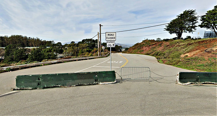 Access from Clarendon Ave now closed
The result of the road closures is that the figure eight of roadways at the top is now half and half, with the eastern half closed to cars and the western half open to cars.
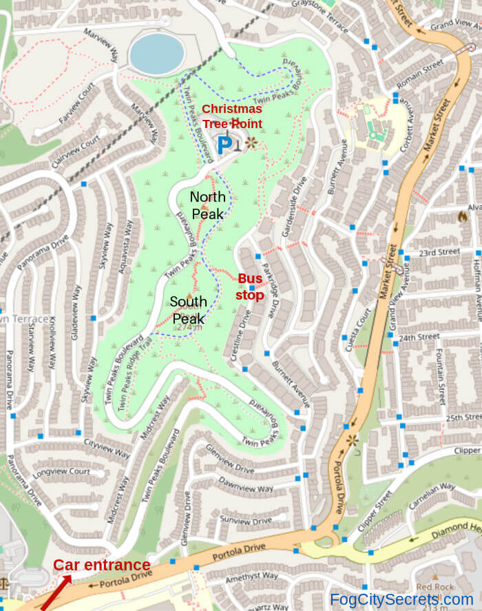
The Bus Stop marked on the map is for the 37-Corbett bus on Crestline Drive, the most convenient way to get there without a car.
Now you can walk from the reservoir area on the north side, all the way past both peaks to the southern end of the park, along the roadway restricted to pedestrians and bikes.
Parking at Twin Peaks - Local tips!
The main parking area at Twin Peaks is at Christmas Tree Point, where the grand panorama of the city of San Francisco can be viewed.
There are coin-operated telescopes at the parking lot that take quarters, but the view is still great without them.
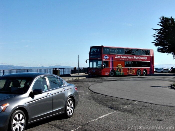 Twin Peaks Main Parking Lot
(The Hop On Hop Off buses don't come up here anymore.)
Local tip: there's another small lot between the two peaks holding maybe 8 cars. Just avoid parking in the marked fire lane.
If the main lot is full, go south after you exit the lot and check the other one. Most people ignore this parking spot.
 More parking on the west side of the divided road
There's also a very small parking area further along, at the back steps leading up to the South Peak. Where Twin Peaks Boulevard splits into car and no car.
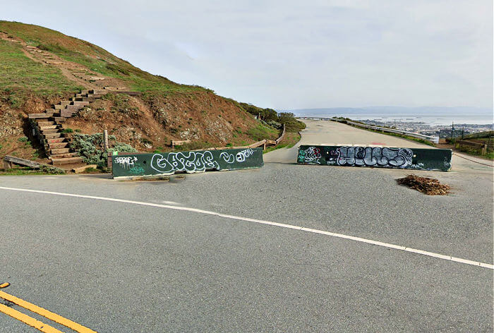 A few more parking spots just south of the South Peak
If you don't mind a little hike, you can also park on the street along Crestline Drive, where the bus stop is. See photo below under Public Transportation.
Is Twin Peaks San Francisco free?
Yes, it's free to go to Twin Peaks. It's free to go there and even the parking lot is free. One of the best free attractions in San Francisco!
Best GPS address for Twin Peaks
The best one is "100 Christmas Tree Point Rd." The loop through the parking lot is named Christmas Tree Point Road.
Why? Because the lot sits on a hill called Christmas Tree Point, named for an annual, lighted Christmas tree displayed there in the late 1920's. (Historical info thanks to outsidelands.org.)
This address takes you to the main parking lot.
"Twin Peaks", and another one sometimes recommended, "501 Twin Peaks Blvd", will both take you to the small parking lot between the two peaks.
Can you get to Twin Peaks by public transportation?
Yes, you can. It's just a bit more complicated than driving.
The Corbett-37 is going up there again. See bus schedules for current info.
It's not that convenient via public transportation. Buses 48 and 52 stop on Portola Drive near the Twin Peaks turnoff (O'Shaughnessy Blvd), but it's a long hike up the mountain from there.
Tip: you can get a lot closer to the top by taking the 37 Corbett Bus and get off at the #74 Crestline Drive stop. From there, a series of rugged steps will take you to the base of the hills.
You can get here from Market Street downtown if you take one of the street car lines J, KT, L or M (it's the subway downtown, running under Market Street). Recently, they have been substituting buses for trains due to some construction on some of these lines, so you would catch the bus on Market street instead of the subway under Market. Check the schedules.
On the J-Church train, get off at the Church and Market stop just after the train comes out of the tunnel; the 37-Corbett bus stop is at Church and 14th Street nearby.
For the KT, L and M trains, get off at the Castro Street station (underground), come up to Castro Street and catch the 37 Corbett bus at Market Street and Castro, close by.
See bus route for the 37-Corbett. There's a Live Map that shows current bus locations.
Path from the 37-Corbett Bus Stop: The bus stop at #74 Crestline is across the street from the path to Twin Peaks.
A taxi ride from downtown to Twin Peaks costs about $20-$25.
Uber or Lyft can get you here, as well.
A fun way to get up there: the little yellow, GPS-guided Go Cars have a route that takes you up to Twin Peaks.
There's an optional detour off the Red Route that guides you up to the top, with narrated info about it.
Read about what riding the Go Cars is like (my experience on both the Red and Blue Routes, with copies of the route maps).
Or see Go Car rentals for more info and booking.
Tours Which Include Twin Peaks
There's a highly-rated walking tour, or rather hiking tour, that takes you up on Twin Peaks, but also explores a lesser-visited view point, Tank Hill. Plus you get to try out the very cool, very steep Seward Street Slides.
See Urban Hikes: Castro & Twin Peaks tour for availability and info.
Another option is to see Twin Peaks as part of a city tour.
Day Tours of Twin Peaks.
There's a popular 4-hour, guided city tour which stops here (weather permitting, which I assume means on days when there is a view). You get to see the major attractions in San Francisco, as well. $65.
To check out the tour, see SF Grand City Tour.
The Vantigo SF City Tour is a highly-rated, city tour that also takes you up to Twin Peaks. This is a small group tour in a VW bus that covers the top SF sights. $95, 3 hours.
See Vantigo SF City Tour for booking and more info.
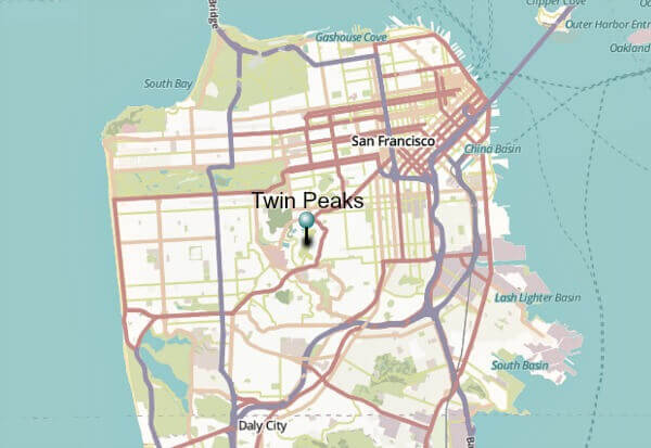
Map of Twin Peaks location in SF
Twin Peaks Weather
Twin Peaks San Francisco has a reputation for intense weather (by California standards). It does tend to be windy and cold, due to its high, exposed position. Twin Peaks gets the full blast of the prevailing winds coming in off the Pacific Ocean.
Twin Peaks is often the dividing line when the fog rolls in, leaving the western half of the City socked in and the eastern half in the sun.
That said, just bring a jacket and you'll be fine.
For everything you've ever wanted to know about San Francisco weather, see fog.
We may have had snow on Twin Peaks on February 5, 2019 during an unusually cold week (but it was during the night, so no one was up there to see it).
The last time Twin Peaks had noticeable snow on it was 43 years earlier, on the very same day, February 5, 1976.
San Francisco Movie Trivia
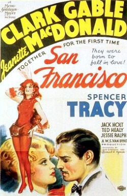
At the end of the film "San Francisco" (the 1936 film with Clark Gable and the song "San Francisco") there is a panoramic view of the City showing the devastation from the 1906 earthquake.
And as you are looking out at the smoldering ruins of the city, the scene morphs into a vision of the future "modern", rebuilt San Francisco. Pretty cool.
That scene was the view from Twin Peaks, circa 1936.
But the early 1990's TV series and film entitled "Twin Peaks" by David Lynch have no connection with our San Francisco Twin Peaks.
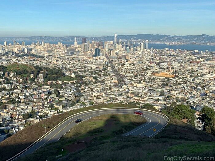 Current View of SF from Twin Peaks
In the view above, you're looking straight down Market Street. The green hill on the left is Corona Heights.
By moving over a little, you can look straight down Market Street to the Ferry Building.

Insider Tip:
There's another hill very close by that also has great views, but very few people visit: Tank Hill. Most locals haven't been there, either.
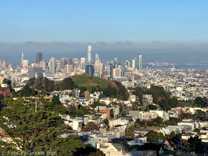 Downtown view from Tank Hill, Corona Heights hill in center
You can also see the Golden Gate Bridge from up here, and over to Oakland as well.
Tank Hill is easy to get to and it's easy to park there. See more info about this local secret!
Walking tour of Twin Peaks, & beyond
Ready to explore some of our coolest hills with a guide? Do the SF Urban Hike: Castro & Twin Peaks that takes you to Twin Peaks, Tank Hill, Mount Sutro, and some other neat places, like the steep, cement Seward slides, all in the same area of the city.
Do you dare to go down the Seward Slides? (See my experience.) To check it out, see hills tour.
More free parking lots in San Francisco...
There are a bunch of great San Francisco attractions that have free parking lots that you can drive to and park with no hassles.
I made of list of over 10 fun places to visit with free parking lots.
More to explore...
Share this page:
