- Home
- Outdoor Activities SF
- Mount Sutro
Explore Mount Sutro
Hike a San Francisco forest

We have a wonderful, forested mountain right in the middle of San Francisco, which many visitors don't know exists. Even most locals are strangers to Mount Sutro.
There are miles of pretty woodland trails skirting around the mountain and climbing to the summit.
The photo below shows a typical trail.
 Historic Trail
Mount Sutro rises to 908 feet in more or less the center of the city, right next to the more famous Twin Peaks, and directly behind the campus of the University of California at San Francisco (UCSF).
Exploring Mount Sutro
All of the trails on Mount Sutro could probably be covered in two hours, and for the most part, the trails are well-maintained (thanks to volunteers with Sutro Stewards) and not strenuous. A hike from the popular Stanyan Street trailhead to the summit and back is a leisurely one hour trip.
Highlights of Mount Sutro
Woodland Creek Area:
This part of the Historic Trail climbs in switchbacks through the ravine.
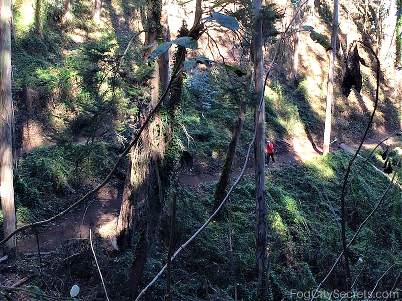 Woodland Creek Ravine
The Fairy Gates:
There are interesting rock outcroppings that bracket parts of the Fairy Gates Trail.
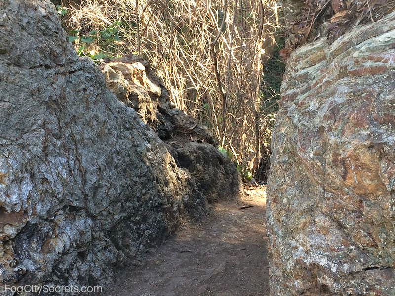 Fairy Gates Trail
The exposed rock is chert, a mixture of sandstone, serpentine, basalt and shale, aged at over 100 million years. Each meter of layers represents about one million years of sedimentary deposits. These rocks started out on the equator and migrated with the moving continents to their present location.
Ishi's Shrine
Along the Historic Trail in the ravine area, there is a cave that has been made into a shrine to Ishi, the last of the tribe of Yahi Indians who had lived in northern California practicing a hunter-gatherer lifestyle.
He was "discovered" in 1911, and spent his last years living at UCSF and roaming the forest on Mount Sutro. See more of Ishi's story here.
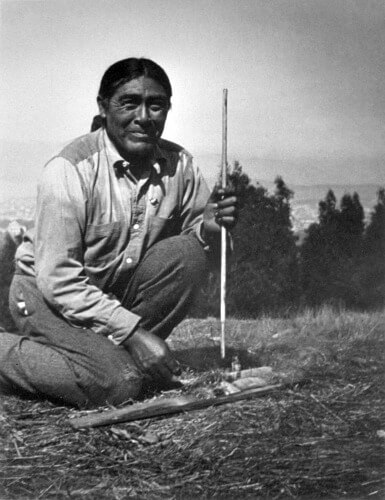 Ishi on Mount Sutro, 1913
San Francisco Views.
There isn't much of a view, but you can get a glimpse of part of the city and the Golden Gate Bride from the Historical Trail above the UCSF buildings.
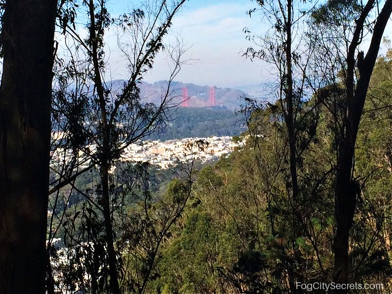 View From Historic Trail
Practical Tips:
- Maps. Print out a trail map before you go. GPS isn't that helpful on the mountain.
- Avoid the mud. It's a better experience when the trails aren't slippery. Don't go after a heavy rain.
- Poison Oak. If you stay on the trail, you'll avoid the unpleasant plant that grows in abundance there!
- Best entry points are the Stanyan, Christopher and Edgewood trailheads.
Beware of Poison Oak
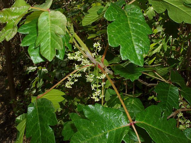 Western Poison Oak
This is what Western Poison Oak (Toxicodendron diversilobum) looks like ; you'll see it all over the mountain and just next to the trails. The volunteers do a great job of maintaining the trails, so you won't encounter it unless you head off into the underbrush (not recommended). Some lucky people don't react to it, but most do.
Mount Sutro Trailheads
There are a number of access points to get into the trail system on the mountain, some more rugged than others.
Stanyan Trailhead
This trailhead is located on Stanyan Street, near 17th Street, and is one of the most heavily used ones. The access point is a wooden stairway between two houses.
Parking in this area can be tight, especially on weekends.
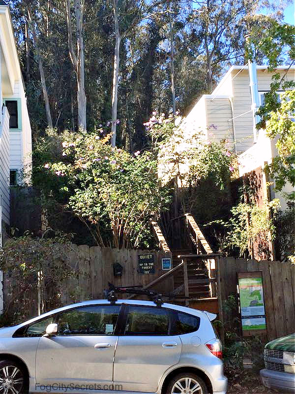 Stanyan Trailhead
Belgrave Entrance
I parked on Belgrave Avenue because I couldn't park on Stanyan, so thought I would just get back to my car the most direct way.
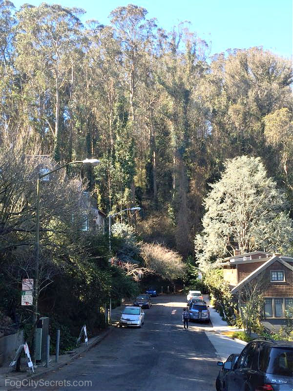 Belgrave Avenue Entrance
The trail isn't really maintained and besides being steep in places, it has a huge fallen tree blocking the path near the exit, requiring some climbing. It passes very close to someone's house, so I felt like I was intruding a bit. Also, I found a homeless man sleeping just off the trail. Better to use the Stanyan Trailhead.
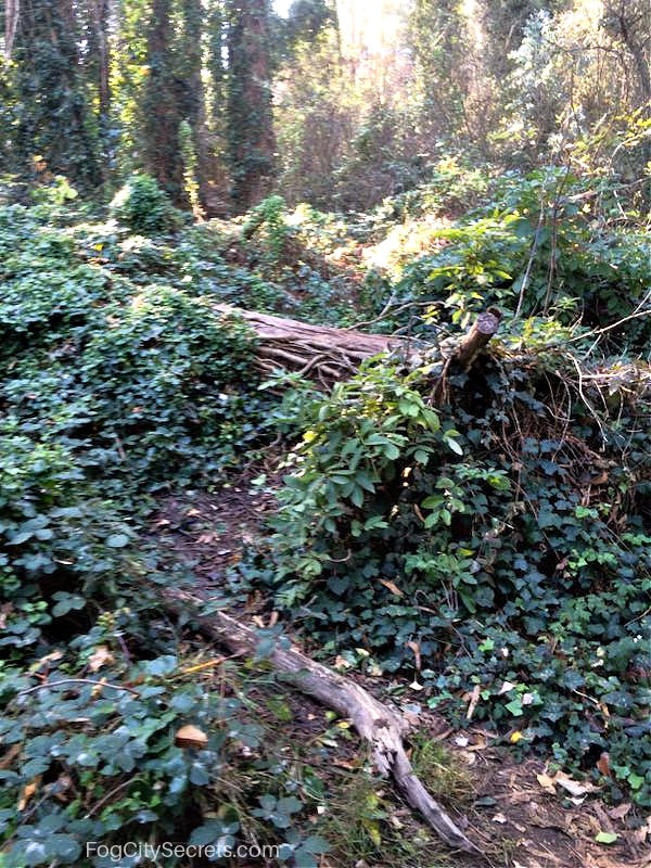 Belgrave Non-trail
Christopher Trailhead
Located on Christopher Drive, the access is a steepish path up a wooded hill. The entrance is a little hard to spot. Easy parking in a residential neighborhood.
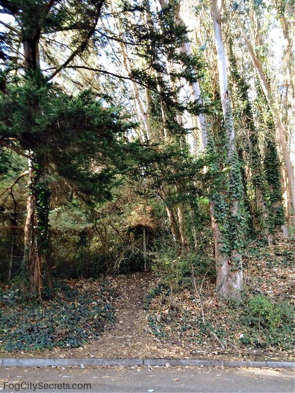 Christopher Drive Trailhead
Crestmont Trailhead
This entry point is just around the bend from Christopher Trailhead, but it's extremely steep, and challenging even when the ground is dry.
I used it to return to my car parked near the Christopher Trailhead once, and never again! I had to slide down on my bottom in two places, it was that steep.
 Historic Trail Near Crestmont Drive
Edgewood Trailhead
Gets you right into the Woodland Creek ravine area. Parking OK there normally.
Campus and Farnsworth Trailheads
These entry points are right near UCSF. Close to N-Judah muni stops for UCSF, but parking is ugly.
Both of these trailheads require walking through parking and housing areas before you get to the forest.
History of Mount Sutro
Mount Sutro is one of four large hills that dominate the San Miguel Range that runs through the center of San Francisco. Up until the mid 1800's, the hills were largely treeless, covered in grass and coastal scrub.
As of 1845, the hills were part of a huge ranch held by the last Spanish mayor of Yerba Buena. Then in 1850, Adolf Sutro, a German immigrant, purchased the land and planted the hill with Monterey Pine, Monterey Cypress and Blue Gum Eucalyptus.
The forest grew, and the Eucalyptus trees came to dominate the landscape. The San Francisco fog creates a microclimate on the hill of cool, damp, drippy greenery, meaning that Mount Sutro can be cool and wet even when it's hot and dry all around.
This area has become a haven for over 60 species of songbirds, as well as a home for hawks, owls, raccoons, coyotes, and salamanders.
Currently, most of the Mt. Sutro forest (61 acres) is owned by UCSF (University of California at San Francisco), with a small portion (19 acres) owned by the city.
Mt. Sutro was the location of a Nike missile base near the summit, which is no longer there
Political Football: why are so many trees being cut?
For over a hundred years, Mt. Sutro was a lush, densely-forested fairyland of Eucalyptus trees and wildlife.
In 2001, UCSF created a long term plan to manage the forest, with an eye to both safety and replacement of non-native plant species with native ones. Their argument was based on findings from arborists that the forest had become unhealthy because of the density of the Eucalyptus trees and the accompanying overgrowth of underbrush and ivy.
Then, around 2013, UCSF proposed a program where they planned to cut round 30,000 trees (out of around 45,000), allegedly because of possible fire and falling tree hazards, and to replace them with native plants. This constituted about 90% of the trees on three-quarters of the total area held by the university. There was strong opposition to the plan and they revised the cutting to a total of around 4,700. They also backed down from their plan to use herbicides to kill all the undergrowth between the trees. UCSF then modified the plan to say it's main objective was safety and not native plant restoration.
Now, walking the trails, you will see large gaps between the trees, and piles of tree trunks and branch debris, which looks to me a lot more hazardous than the lush, damp green forest would have been.
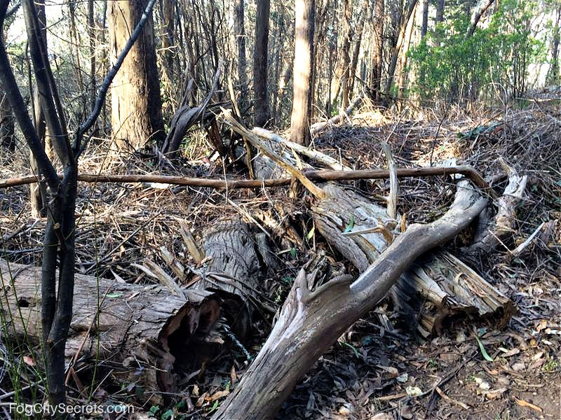
The reasons given for the tree clearing are the fire hazard and improvement the health of the larger trees by giving them more space to get sun and nutrients.
One of the issues associated with all this chopping involves a strange fanaticism that has developed in the Bay Area around "non-native" plants.
Eucalyptus trees, originally brought here from Australia a hundred years ago, have become widespread in the Bay Area and have adapted well to the Mediterranean climate. However, there is now a faction that wants to rid San Francisco of any plant that wasn't here when the city was settled. Mt. Sutro has (had?) a Eucalyptus forest and has been targeted as a result.
The claim is that the trees are a fire hazard and that there is a danger from falling trees and branches because of the declining health of the trees. There is currently a struggle going on between those who want to preserve the Sutro forest as is and those who favor radical removal of large numbers of trees.
It is not in dispute that the forest is not nearly as attractive and lush as it used to be, as recently as 2011. Sad to see. Many more trees are marked for destruction as well; you can see the painted dots on the trunks of the future victims.
Side note. The native-plant fanatics were responsible for cutting down a whole bunch of Eucalyptus trees in Pine Lake Park in my neighborhood a few years ago. Now, instead of a pretty view of trees ringing the meadow, we can see the ugly backs of all the houses that surround the park. Very natural-looking. They even had a plan to introduce a particular species native plant into the heavily-used park: poison oak! Fortunately, their plan was discovered before the evil deed occurred, and the ensuing outrage blocked that course of action. Mount Sutro already has lots of poison oak, lol.
Apparently, the heavy cutting in the Sutro forest was sill happening in 2022.
If you want to read more about the tree-cutting issue, check out the following websites: for preserving the Sutro forest as is, see sutroforest.com, and in favor of large-scale cutting, see sutrostewards.org
Getting to Mount Sutro
Public Transportation
The N-Judah streetcar stops near some of the trailheads. Get off at the Carl and Stanyan stop for the Stanyan trailhead, or the Carl and Hillway stop for the Edgewood, Campus and Farnsworth trailheads.
You can catch the N-Judah underground anywhere along Market Street in the downtown area.
Parking at Mount Sutro
Other than the Campus trailhead, the Mount Sutro entrances are in residential neighborhoods with free street parking. Check for 2 hour parking limit signs.
Parking is easiest for the Crestmont and Christopher trailheads. For the Stanyan Street entrance, you might find a spot on Stanyan; if not, try Belgrave Avenue around the corner.
Maps of Mount Sutro
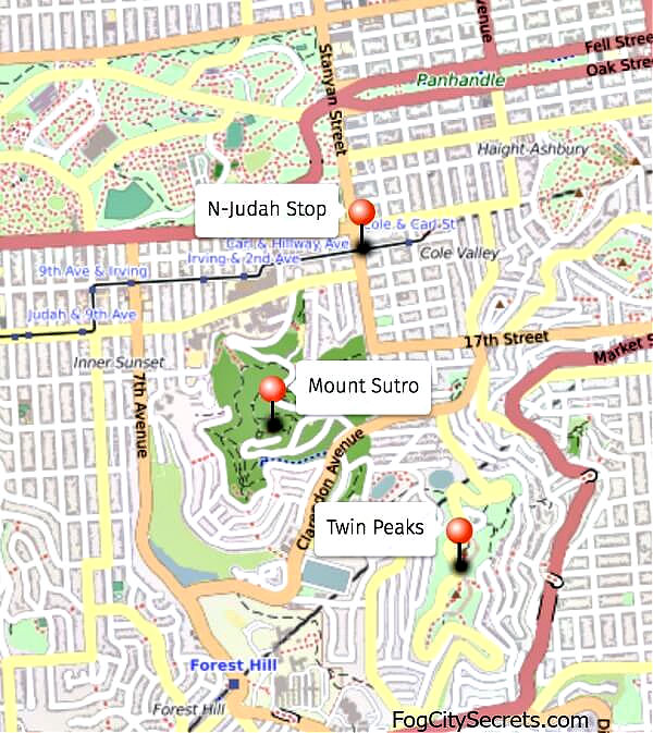

Need a good map? To visit the sutrosewards.org site where you can download a handy trail map, click here.
I regretted not printing out a trail map the first time I went. There were some signs, but not enough. I did make it to the top and back, but I got turned around a few times.
There is good smart phone reception in the forest, but GPS was only somewhat helpful. Google maps sometimes showed me the correct location and other times told me I was in the middle of the woods when I was actually on a trail. The Sutro Stewards map (above) was great.
More beautiful places to see...
Share this page:
