The Embarcadero
of San Francisco
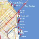
The Embarcadero is the boulevard that runs all along the waterfront of San Francisco, from the Bay Bridge, past the Ferry Building, and down to Pier 39 and Fisherman's Wharf.
A number of San Francisco attractions are sprinkled along this street and it's a popular place for strolling.
It's also not a bad area to actually find parking in one of San Francisco's busiest areas.
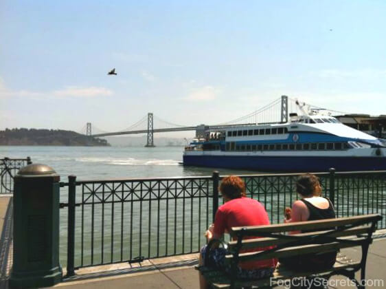
Highlights of the Embarcadero...
The Ferry Building
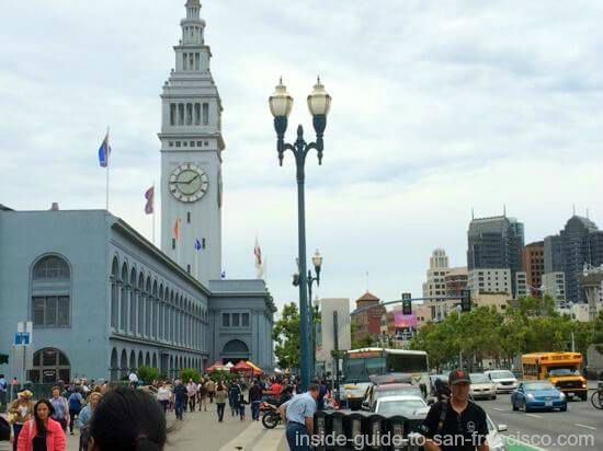
San Francisco's main ferry terminal has morphed into a gourmet hotspot. Inside the building is a collection of gastronomically-interesting booths and eating places to tempt visitors with special condiments, desserts, wines, and numerous other delicacies.
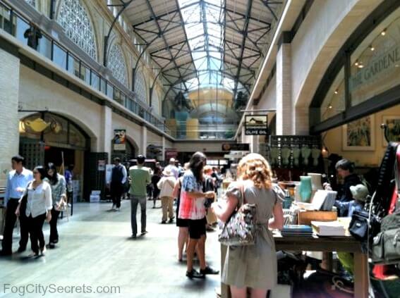
This is also the site of a popular farmer's market held here on Tuesdays and Thursdays (10 to 2) and Saturdays (8 to 2).
The Blue and Gold Line runs ferries from here to Sausalito, Oakland, Alameda, Vallejo and Larkspur.
Pier 14
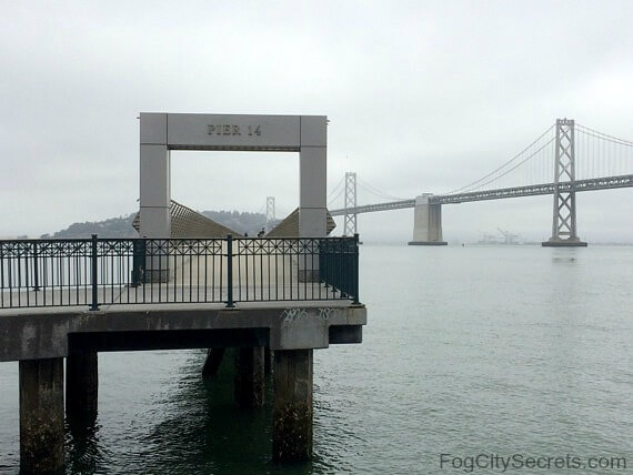
Pier 14 is a popular pier that lies between the Bay Bridge and the Ferry Building. It's a pedestrian walkway that stretches far out into the bay with great views of the city, the bridge and Yerba Buena Island.
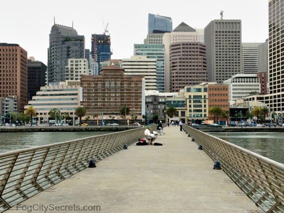
This is a good place to watch the ships crossing under the Bay Bridge, and the ferries coming and going to the Ferry Building nearby. The end of the pier is a also popular fishing spot.
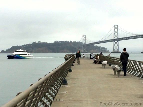
There's a series of metal plates along the pier with excerpts from Rudyard Kipling's poem, The Sea and the Hills. In part:
Who hath desired the Sea? Her menaces swift as her mercies?
The in-rolling walls of the fog and the silver-winged breeze that disperses?
It was on Pier 14 that Kate Steinle was killed in July 2015 by an illegal alien with a long criminal record who had already been deported 5 times, and who was released by SF Sheriff's office because of the San Francisco's sanctuary city policy. People often put flowers at the place where she died.
This is still a very popular pier, and it's actually in a very safe area, which made the attack even more shocking.
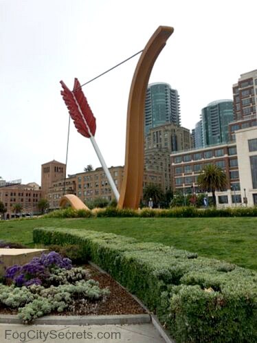
Since 2002, a huge sculpture of Cupid's bow and arrow has decorated the area near Pier 14 at the base of the Bay Bridge. Some people love it and others don't; I think it's pretty cool.
Hornblower Cruises - Pier 3
Hornblower runs its cruise ships out of Pier 3; they have a nice selection of bay cruises. There's some limited public parking available as well.

Hornblower has a great San Francisco dinner/dance cruise. Delicious food and amazing views of the city and bridges. For more details, and photos of this cruise, see my page on the SF dinner cruise.
Pier 7
This is a great pier for strolling; good bay and city views.
The Exploratorium - Pier 15
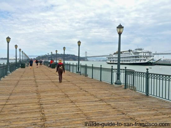
The new home of the Exploratorium, our fun, hands-on, science museum and play place, is now at Pier 15. See more on the Exploratorium.
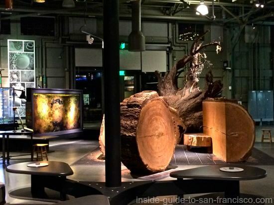
Pier 23
Pier 23 is home to a cavernous parking area and the eponymous restaurant. The Pier 23 cafe is a fun place to eat; down to earth burgers and seafood, a bit funky, with seating in back right on the water.
Cruise Ship Terminal - Pier 27
Pier 27 is the location of the new (since 2015) cruise ship terminal for San Francisco.
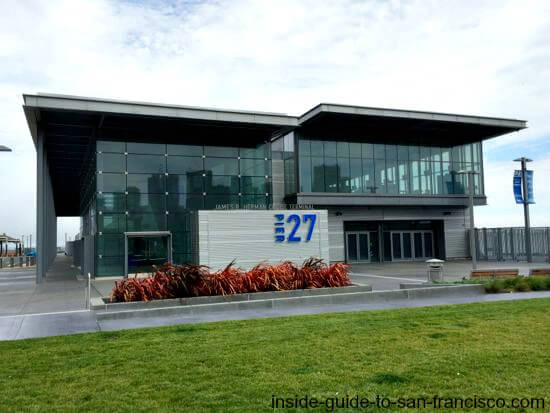
The terminal is a modern, two-level structure designed accommodate the 60 to 80 cruise ships that dock in San Francisco every year. The new terminal is a "green" building that collects rainfall on its roof. A large parking lot is adjacent.

Tip for cruise ship passengers: there are two garages near the waterfront that provide special arrangements for parking your car during a cruise. You can book a space online at either one:
- Anchorage Garage at 500 Beach Street in Fisherman's Wharf.
- Impark Garage at 80 Francisco Street, a couple of blocks from the cruise terminal.

(image courtesy of the San Francisco History Center,
San Francisco Public Library)
Alcatraz Landing - Pier 33
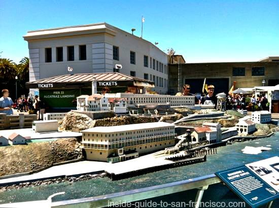
The ferry for Alcatraz leaves from Pier 33. For tips on how to get tickets and what to expect on the Alcatraz tour, see Alcatraz.
Pier 39
This is San Francisco's waterfront shopping and entertainment pier. Pier 39 marks the end of the Embarcadero and the beginning of Fisherman's Wharf.

See more information on Pier 39 attractions.
Transport for Weary Feet
Seeing San Francisco typically involves a lot of walking. If you want to save your feet a bit, there are pedicabs available near the Ferry Building.


Or try the relatively new service, the Water Taxi, from Pier 1 ½, next door to the Ferry Building. This little boat runs from here to the Hyde Street Pier at the far end of Fisherman's Wharf (only stop), or in the opposite direction to AT&T Park.
Runs frequently and costs $10 one-way ($5 for SF residents).
The Embarcadero was also a busy port during the Gold Rush era. The area was called Yerba Buena Cove, named after Yerba Buena Island nearby (where the two sections of the Bay Bridge attach now).
The photo below was the view of the Embarcadero area as it looked in 1851, looking towards Yerba Buena Island and the Berkeley hills across the bay.

- Home >
- SF Attractions >
- The Embarcadero
